
Read the full article on KETV 7

Cloudy, cool Monday afternoon for Omaha area
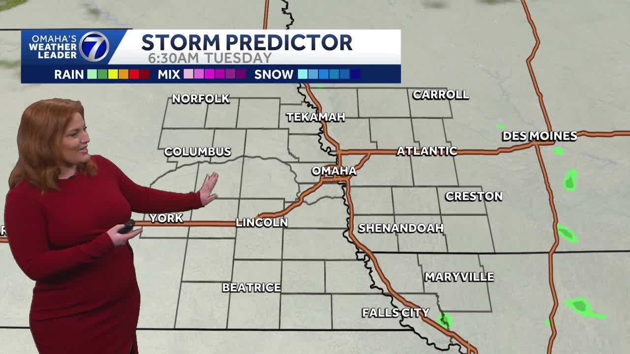
NOW FROM OMAHA’S WEATHER LEADER, METEOROLOGIST CAITLIN HARVEY, WITH THE ACCURATE FORECAST, YOU CAN TRUST. 1211 RIGHT NOW, AS WE START WITH THE LIVE LOOK OUT OVER WEST OMAHA. THIS VIEW FROM OUR CAMERA AT METHODIST WOMEN’S HOSPITAL. WEST DODGE THERE, FOLKS HEADING OUT TO LUNCH. AND YEAH, WE’RE STILL DRY, BUT JUST LOOKING, FEELING DREARY. COOL HERE TODAY, 43 DEGREES RIGHT NOW. FEELING LIKE 38 FOR OMAHA, 40 NOW NORFOLK FEELING LIKE 31 AND 45. FEELING LIKE 40 IN MARYVILLE. LIVE SUPER DOPPLER WITH OUR THREE MINUTE ADVANTAGE STILL SHOWING OUR CLOUD COVER WALL TO WALL. WE’LL KEEP THAT WITH US HERE TODAY, BUT DRY OUTSIDE OF SOME ISOLATED MIST AND DRIZZLE. THAT WILL REALLY BE THE STORY FOR THE REST OF THE AFTERNOON. WELL, CLOUD COVER GOING TO HELP KEEP TEMPERATURES A LITTLE COOLER CLOSER TO WHERE WE SHOULD BE HERE, THOUGH, FOR THE BEGINNING OF MARCH. OUR AVERAGE HIGH 45 UP TO 44 HERE TODAY IN OMAHA 48. SHENANDOAH, 42 COLUMBUS AND 45 THIS AFTERNOON IN FALLS CITY. ALL WITH THOSE WINDS UP TO ABOUT TEN MILES AN HOUR. NOT TOO BREEZY. IMPACT WEATHER TONIGHT CLOUDY. 30% CHANCE FOR SOME OF THAT DRIZZLE. LIGHT SHOWERS, LOW OF 35. THOUGH WE COULD SEE ISOLATED SPOTS. MAYBE DIP CLOSER TO FREEZING. LEAD TO THE POTENTIAL FOR SOME ISOLATED SLICK SPOTS TOMORROW. STORM PREDICTOR AS WE HEAD THROUGHOUT THE DAY TODAY. AGAIN, THOSE CLOUDS NOT GOING ANYWHERE. SEEING SHOWER CHANCES FURTHER NORTH OUT OF THE VIEWING AREA, CLOSER ON INTO SOUTH DAKOTA BY OVERNIGHT, SEES THOSE CLOUDY SKIES AND THOSE SLIGHT CHANCES FOR SOME LIGHT RAIN SHOWERS AND DRIZZLE. WAKING UP 630 TUESDAY. CLOUDS STILL WITH US. UNFORTUNATELY NOT GOING TO BE GOOD VIEWING CONDITIONS FOR THE FULL BLOOD MOON TONIGHT. MOSTLY CLOUDY SKIES STAYING WITH US THROUGHOUT THE DAY TUESDAY WITH THAT CHANCE FOR SHOWERS TOMORROW. RIGHT AROUND 30%. AGAIN, THEY’RE GOING TO BE FEW AND FAR BETWEEN THIS WEEK. STILL LOOKING MUCH MORE ACTIVE AS FAR AS RAIN POTENTIAL IS CONCERNED. AND THURSDAY NIGHT INTO FRIDAY AND FRIDAY NIGHT, MORE OPPORTUNITIES FOR NOT ONLY RAIN, BUT STORMS AS WELL. IMPACT WEATHER FOR YOUR FRIDAY. RIGHT NOW, THE STORM PREDICTION CENTER BRINGING A 15% CHANCE FOR FAR SOUTHEASTERN NEBRASKA, NORTHWEST MISSOURI, SOUTHERN IOWA FOR ANY STRONGER, EVEN ISOLATED SEVERE STORMS IN THAT AREA. SO SEVEN-DAY FORECAST IMPACT WEATHER TONIGHT, TOMORROW, WEDNESDAY, THURSDAY NIGHT AND FRIDAY. BUT TEMPERATURES AT LEAST ON THE UPTICK 44 T
Advertisement
Cloudy skies and chances for mist and drizzle Monday afternoon. More opportunities for rain and thunderstorms throughout the week ahead.With a combined 50 years covering weather in Nebraska and Iowa, KETV NewsWatch 7 is Omaha’s Weather Leader. Led by Omaha’s Chief Meteorologist Bill Randby, the award-winning team of Sean Everson, Caitlin Harvey and Luke Vickery are focused on alerting you to upcoming severe weather and KETV’s exclusive live radar gives you a 3-minute advantage when storms strike.
Cloudy skies and chances for mist and drizzle Monday afternoon. More opportunities for rain and thunderstorms throughout the week ahead.
With a combined 50 years covering weather in Nebraska and Iowa, KETV NewsWatch 7 is Omaha’s Weather Leader. Led by Omaha’s Chief Meteorologist Bill Randby, the award-winning team of Sean Everson, Caitlin Harvey and Luke Vickery are focused on alerting you to upcoming severe weather and KETV’s exclusive live radar gives you a 3-minute advantage when storms strike.
Advertisement