
Read the full article on KETV 7
Severe storm chances return Thursday afternoon and evening as a cold front moves through. Omaha’s Weather Leader has deemed Thursday a severe weather day with strong storms possible. The National Weather Service has issued a tornado watch for much of eastern Nebraska, western Iowa and northwest Missouri until 7 p.m. Thursday.The following Nebraska counties are affected by the tornado watch:BurtCassDodgeDouglasGageJeffersonJohnsonLancasterNemahaOtoePawneeRichardsonSalineSarpySaundersThurstonWashingtonThe following Iowa counties are affected by the tornado watch:AdairAdamsAudubon Buena VistaCalhounCarrollCrawfordCherokeeClayDickinsonEmmetFremontGreeneGuthrieHancockIdaKoussuthMillsO’BrienOsceolaPagePalo AltoPlymouthPocahontasPottawattamieRinggoldSacShelbySiouxTaylorUnionWebsterWinnebagoWoodburyWrightUpdate: Tornado warnings were issued for Monona County, Iowa, as well as Jefferson, Gage, and Saline counties in Nebraska but they have since expired.Thursday severe timelineAs of Thursday morning, the Storm Prediction Center’s severe weather outlook has areas around and east of the Omaha metro in a slight risk for severe activity Thursday afternoon and evening. All modes of severe weather are in play when storms develop and then damaging wind will be the main threat near and after sunset.Current model trends favor storm development near the Omaha metro after 2 p.m. Thursday.Here’s a look what forecast models are projecting could happen during Thursday’s evening commute.Storms will likely be east of the metro area by 5 p.m. After sunset, models are hinting at damaging winds being the main threat as a line of storms move through Iowa.The main window for severe storms will be between 2 p.m. and 7 p.m.Douglas County burn banDouglas County issued a burn ban Monday “based on the current and predicted future dry and windy forecasted conditions.”Stay updated on the latest weather forecast by downloading the KETV mobile app.With a combined 50 years covering weather in Nebraska and Iowa, KETV NewsWatch 7 is Omaha’s Weather Leader. Led by Omaha’s Chief Meteorologist Bill Randby, the award-winning team of Sean Everson, Caitlin Harvey and Luke Vickery are focused on alerting you to upcoming severe weather and KETV’s exclusive live radar gives you a 3-minute advantage when storms strike.Make sure you can always see the latest news, weather, sports and more from KETV NewsWatch 7 on Google search.NAVIGATE: Home | Weather | Local News | National | Sports | Newscasts on demand |
Severe storm chances return Thursday afternoon and evening as a cold front moves through. Omaha’s Weather Leader has deemed Thursday a severe weather day with strong storms possible.
The National Weather Service has issued a tornado watch for much of eastern Nebraska, western Iowa and northwest Missouri until 7 p.m. Thursday.
Advertisement
The following Nebraska counties are affected by the tornado watch:
- Burt
- Cass
- Dodge
- Douglas
- Gage
- Jefferson
- Johnson
- Lancaster
- Nemaha
- Otoe
- Pawnee
- Richardson
- Saline
- Sarpy
- Saunders
- Thurston
- Washington
The following Iowa counties are affected by the tornado watch:
- Adair
- Adams
- Audubon
- Buena Vista
- Calhoun
- Carroll
- Crawford
- Cherokee
- Clay
- Dickinson
- Emmet
- Fremont
- Greene
- Guthrie
- Hancock
- Ida
- Koussuth
- Mills
- O’Brien
- Osceola
- Page
- Palo Alto
- Plymouth
- Pocahontas
- Pottawattamie
- Ringgold
- Sac
- Shelby
- Sioux
- Taylor
- Union
- Webster
- Winnebago
- Woodbury
- Wright
Update: Tornado warnings were issued for Monona County, Iowa, as well as Jefferson, Gage, and Saline counties in Nebraska but they have since expired.

Thursday severe timeline
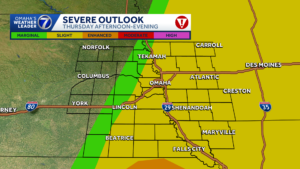
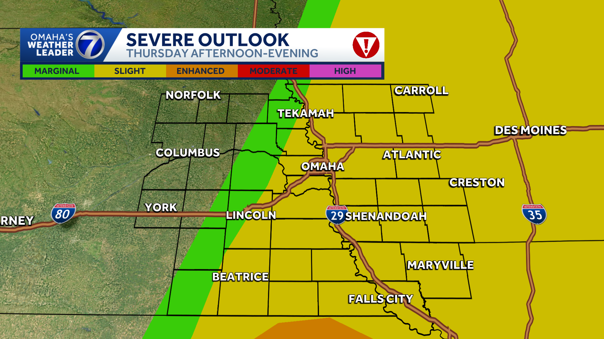
As of Thursday morning, the Storm Prediction Center’s severe weather outlook has areas around and east of the Omaha metro in a slight risk for severe activity Thursday afternoon and evening.
All modes of severe weather are in play when storms develop and then damaging wind will be the main threat near and after sunset.

Current model trends favor storm development near the Omaha metro after 2 p.m. Thursday.

Here’s a look what forecast models are projecting could happen during Thursday’s evening commute.

Storms will likely be east of the metro area by 5 p.m. After sunset, models are hinting at damaging winds being the main threat as a line of storms move through Iowa.

The main window for severe storms will be between 2 p.m. and 7 p.m.
Douglas County burn ban
Douglas County issued a burn ban Monday “based on the current and predicted future dry and windy forecasted conditions.”
Stay updated on the latest weather forecast by downloading the KETV mobile app.
With a combined 50 years covering weather in Nebraska and Iowa, KETV NewsWatch 7 is Omaha’s Weather Leader. Led by Omaha’s Chief Meteorologist Bill Randby, the award-winning team of Sean Everson, Caitlin Harvey and Luke Vickery are focused on alerting you to upcoming severe weather and KETV’s exclusive live radar gives you a 3-minute advantage when storms strike.
Make sure you can always see the latest news, weather, sports and more from KETV NewsWatch 7 on Google search.
NAVIGATE: Home | Weather | Local News | National | Sports | Newscasts on demand |