
Read the full article on KETV 7
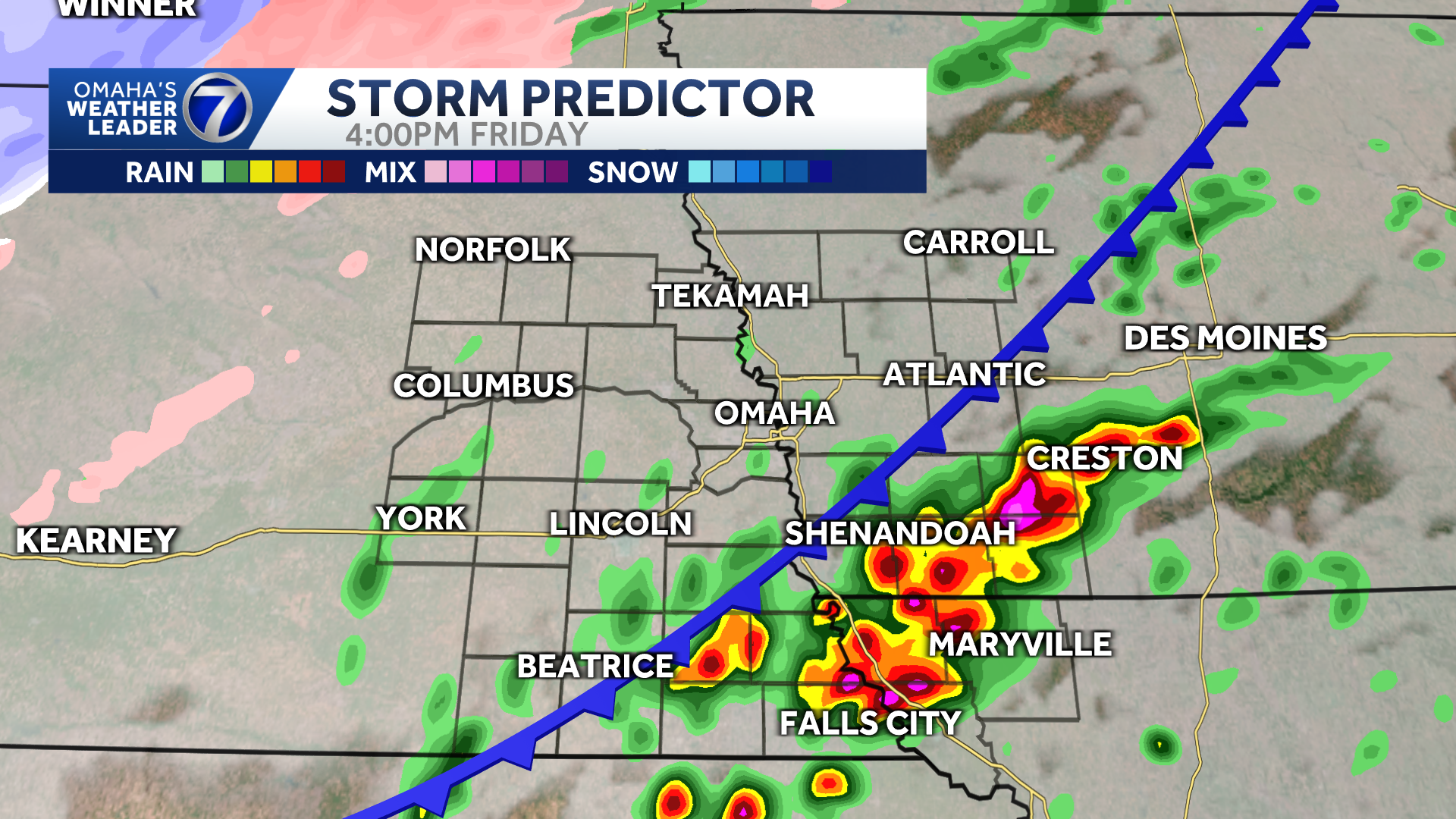
Thunderstorms and rain Friday morning will move out mid-morning, providing a bit of a break before strong to severe storm chances return Friday afternoon. Omaha’s Weather Leader has deemed Friday a severe weather day with severe storms possible late in the day. Friday afternoon-evening storm potentialAnother round of storms is possible Friday afternoon and evening as a cold front moves through the area. Interactive Radar: Track the severe weather wherever you areBill Randby says the threat depends upon timing of a cold front and getting some sunshine to heat up the atmosphere.As of Friday morning, the Storm Prediction Center has southeast Nebraska, northwest Missouri and southwest Iowa in an enhanced risk for severe storms, including the Omaha and Lincoln area, as well as much of I-29 and I-80. Large hail up to 2.00 inches in diameter, damaging wind gusts up to 75 mph, and a couple of tornadoes are possible. Friday afternoon-evening storm timelineChance for severe storms increase after 3 p.m. Friday. A quick-moving cold front passage will bring the greatest risk for severe potential into southeast Nebraska, southwest Iowa, and northwest Missouri between 3 p.m. and 9 p.m.Storms will be possible in the Omaha metro between 5 p.m. and 8 p.m., which could affect the evening commute.Winter weather potentialAs cold air pushes in behind our cold front, wintry mix is expected this evening before changing over to snow in northeast Nebraska. The National Weather Service in Omaha has issued a winter weather advisory for Madison, Stanton, Cuming, Colfax and Platte Counties, Nebraska, from 12 p.m. Friday until 12 p.m. Saturday. During this time, up to 1 inch of snow is possible along with a glaze of ice. Flash freeze conditions could also occur. Expect slick conditions and hazardous travel, especially on overpasses and bridges.Stay updated on the latest weather forecast by downloading the KETV mobile app.With a combined 50 years covering weather in Nebraska and Iowa, KETV NewsWatch 7 is Omaha’s Weather Leader. Led by Omaha’s Chief Meteorologist Bill Randby, the award-winning team of Sean Everson, Caitlin Harvey and Luke Vickery are focused on alerting you to upcoming severe weather and KETV’s exclusive live radar gives you a 3-minute advantage when storms strike.Make sure you can always see the latest news, weather, sports and more from KETV NewsWatch 7 on Google search.NAVIGATE: Home | Weather | Local News | National | Sports | Newscasts on demand |
Thunderstorms and rain Friday morning will move out mid-morning, providing a bit of a break before strong to severe storm chances return Friday afternoon.
Omaha’s Weather Leader has deemed Friday a severe weather day with severe storms possible late in the day.
Advertisement
Friday afternoon-evening storm potential
Another round of storms is possible Friday afternoon and evening as a cold front moves through the area.
Interactive Radar: Track the severe weather wherever you are
Bill Randby says the threat depends upon timing of a cold front and getting some sunshine to heat up the atmosphere.
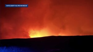
As of Friday morning, the Storm Prediction Center has southeast Nebraska, northwest Missouri and southwest Iowa in an enhanced risk for severe storms, including the Omaha and Lincoln area, as well as much of I-29 and I-80. Large hail up to 2.00 inches in diameter, damaging wind gusts up to 75 mph, and a couple of tornadoes are possible.

Friday afternoon-evening storm timeline
Chance for severe storms increase after 3 p.m. Friday.
A quick-moving cold front passage will bring the greatest risk for severe potential into southeast Nebraska, southwest Iowa, and northwest Missouri between 3 p.m. and 9 p.m.
Storms will be possible in the Omaha metro between 5 p.m. and 8 p.m., which could affect the evening commute.
Winter weather potential
As cold air pushes in behind our cold front, wintry mix is expected this evening before changing over to snow in northeast Nebraska.
The National Weather Service in Omaha has issued a winter weather advisory for Madison, Stanton, Cuming, Colfax and Platte Counties, Nebraska, from 12 p.m. Friday until 12 p.m. Saturday.

During this time, up to 1 inch of snow is possible along with a glaze of ice. Flash freeze conditions could also occur. Expect slick conditions and hazardous travel, especially on overpasses and bridges.
Stay updated on the latest weather forecast by downloading the KETV mobile app.
With a combined 50 years covering weather in Nebraska and Iowa, KETV NewsWatch 7 is Omaha’s Weather Leader. Led by Omaha’s Chief Meteorologist Bill Randby, the award-winning team of Sean Everson, Caitlin Harvey and Luke Vickery are focused on alerting you to upcoming severe weather and KETV’s exclusive live radar gives you a 3-minute advantage when storms strike.
Make sure you can always see the latest news, weather, sports and more from KETV NewsWatch 7 on Google search.
NAVIGATE: Home | Weather | Local News | National | Sports | Newscasts on demand |