
Read the full article on KETV 7
EARLIER, DEVIN SAYS IT HIT A NEARBY HOME, CAUSED SOME TREE DAMAGE. GOVERNOR JIM PILLEN SAYS ON TWITTER. MY EMERGENCY MANAGEMENT TEAM AND I ARE MONITORING DAMAGE REPORTS FROM THE STORMS THAT MOVED ACROSS NEBRASKA THIS EVENING. WE WILL CONTINUE TO GATHER INFORMATION AND PROVIDE STATE RESOURCES TO HELP WITH WHATEVER CLEANUP IS NECESSARY. IN PARTICULAR, WE ARE AWARE OF SEVERAL HOMES DAMAGED OR DESTROYED IN HOWARD COUNTY
Advertisement
Severe storms bring tornadoes, hail and strong winds to Nebraska, Iowa on Sunday evening

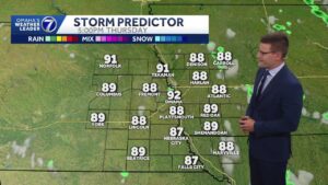
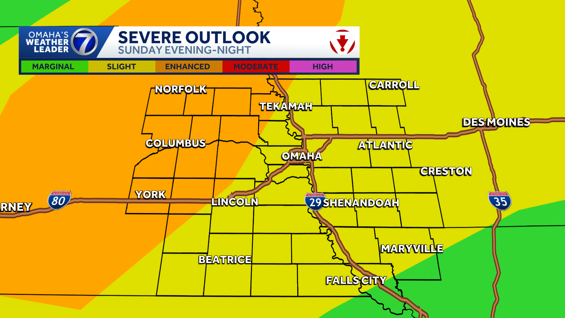
An active stretch of weather continues this weekend into next week with multiple chances for storms with severe potential. Omaha’s Weather Leader has deemed Sunday and Monday severe weather days. Tornado watches, warnings SundayThe National Weather Service said a tornado warning for part of Montgomery and Pottawattamie counties in southwestern Iowa expired at 9:45 p.m. According to the NWS, a confirmed tornado was located over Glenwood, about 11 miles southeast of Offutt Air Force Base, around 9 p.m. A tornado warning that included parts of Sarpy, Douglas, Saunders, Cass and Washington counties in Nebraska was allowed to expire. Photos, videos: Severe weather moves through Nebraska, IowaA confirmed tornado was on the ground near Hebron around 7 p.m. NWS also issued a tornado watch for parts of Nebraska and Iowa as severe weather moves through the area Sunday. Monday severe potentialAs of Sunday morning, the Storm Prediction Center has areas from Omaha to Lincoln and to the south and east in an enhanced zone for severe activity for Monday. Far southeast Nebraska is in a moderate risk zone. Chances for severe storms will go up after 3 p.m. Monday as a cold front passes. Very large hail, 65 to 75 mile per hour wind gusts, and a few, strong tornadoes will be possible with any stronger storms that develop.Stay updated on the latest weather forecast by downloading the KETV mobile app.With a combined 50 years covering weather in Nebraska and Iowa, KETV NewsWatch 7 is Omaha’s Weather Leader. Led by Omaha’s Chief Meteorologist Bill Randby, the award-winning team of Sean Everson, Caitlin Harvey and Luke Vickery are focused on alerting you to upcoming severe weather and KETV’s exclusive live radar gives you a 3-minute advantage when storms strike.Make sure you can always see the latest news, weather, sports and more from KETV NewsWatch 7 on Google search.NAVIGATE: Home | Weather | Local News | National | Sports | Newscasts on demand |
An active stretch of weather continues this weekend into next week with multiple chances for storms with severe potential. Omaha’s Weather Leader has deemed Sunday and Monday severe weather days.
Tornado watches, warnings Sunday
Advertisement
The National Weather Service said a tornado warning for part of Montgomery and Pottawattamie counties in southwestern Iowa expired at 9:45 p.m.
According to the NWS, a confirmed tornado was located over Glenwood, about 11 miles southeast of Offutt Air Force Base, around 9 p.m.
A tornado warning that included parts of Sarpy, Douglas, Saunders, Cass and Washington counties in Nebraska was allowed to expire.
Photos, videos: Severe weather moves through Nebraska, Iowa
A confirmed tornado was on the ground near Hebron around 7 p.m.
NWS also issued a tornado watch for parts of Nebraska and Iowa as severe weather moves through the area Sunday.
Monday severe potential
As of Sunday morning, the Storm Prediction Center has areas from Omaha to Lincoln and to the south and east in an enhanced zone for severe activity for Monday. Far southeast Nebraska is in a moderate risk zone. Chances for severe storms will go up after 3 p.m. Monday as a cold front passes. Very large hail, 65 to 75 mile per hour wind gusts, and a few, strong tornadoes will be possible with any stronger storms that develop.

Stay updated on the latest weather forecast by downloading the KETV mobile app.
With a combined 50 years covering weather in Nebraska and Iowa, KETV NewsWatch 7 is Omaha’s Weather Leader. Led by Omaha’s Chief Meteorologist Bill Randby, the award-winning team of Sean Everson, Caitlin Harvey and Luke Vickery are focused on alerting you to upcoming severe weather and KETV’s exclusive live radar gives you a 3-minute advantage when storms strike.
Make sure you can always see the latest news, weather, sports and more from KETV NewsWatch 7 on Google search.
NAVIGATE: Home | Weather | Local News | National | Sports | Newscasts on demand |