
Read the full article on KETV 7
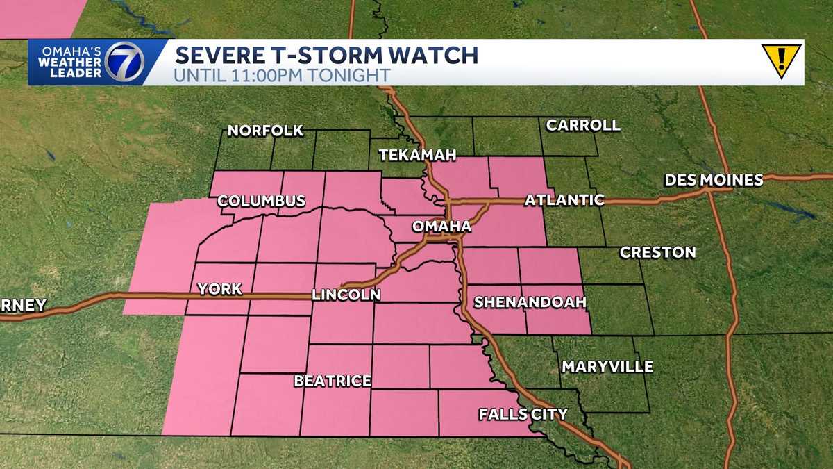
Omaha weather: Severe storms moving through Nebraska, Iowa
Our hot and humid stretch will continue into the holiday weekend. Storm chances could also impact your Fourth of July plans.
Omaha’s Weather Leader has deemed Friday a severe weather day with the potential for severe storms in the evening and overnight hours.
Advertisement
A flood advisory has been issued for parts of Douglas and Sarpy counties until 11:45 p.m.
The Omaha metro, along with most of southeast Nebraska and southwest Iowa are under a severe thunderstorm watch until 11 p.m.
Hot and humid stretch continues
Plan for daily highs in the upper 80s and low 90s with feels like temperatures up to 100 degrees each day through Saturday. Parts of southwest Iowa and northwest Missouri are under an extreme heat warning.
Friday severe threat
Increasing chances for strong to severe storms in the evening and overnight hours. Best chances will likely be after 7 p.m. in southeast Nebraska.
The Storm Prediction Center has most of the KETV viewing area in a severe thunderstorm watch until 11 p.m..
Fourth of July storm chances
Plan for a hot and humid Fourth of July with highs around 90 degrees and feels like temperatures near the triple digits during the afternoon and early evening.
Storm chances Saturday evening into Saturday night are trending more south of the Omaha metro. Most celebrations will likely stay dry.
Stay updated on the latest weather forecast by downloading the KETV mobile app.
With a combined 50 years covering weather in Nebraska and Iowa, KETV NewsWatch 7 is Omaha’s Weather Leader. Led by Omaha’s Chief Meteorologist Bill Randby, the award-winning team of Sean Everson, Caitlin Harvey, Luke Vickery, and Ainsley Goebel are focused on alerting you to upcoming severe weather and KETV’s exclusive live radar gives you a 3-minute advantage when storms strike.